Climate, crops and communities: ASSAR's East Africa team makes headway on its first regional scoping visit
by Jennifer Leavy, University of East Anglia
With team members located in three parts of the world – Nairobi, Addis Ababa and far-flung Norwich – the ASSAR East Africa Team’s recent regional visit in November 2014 was an opportunity for team members to meet in Kenya and Ethiopia for the first of two regional scoping visits.
The purpose of the visit was three-fold: i) Initial meetings and interviews with key stakeholders and policy-makers in both countries ii) team meeting and writing workshop and iii) scoping visits to potential research sites in Ethiopia to prepare for ASSAR’s Phase 2 research.

Meetings were held with stakeholders, including policy makers, NGOs and local government working on climate change adaptation and with communities on the ground. These provided an important opportunity for us to hear about activities and priorities in-country at a range of levels. We introduced the ASSAR programme and shared information about what ASSAR hopes to do in the region. This was also a first opportunity for feedback from national-level stakeholders on the project approach.
Discussions centred around i) what people think are the most critical issues relating to climate impacts, vulnerability and adaptation in semi-arid areas (including wider development pressures or challenges); ii) what people see as the main research needs in order to address these issues and strengthen resilience (especially of the more vulnerable social groups); iii) What key initiatives/ projects/ upcoming events and documents we should know about.
In Nairobi we heard about administrative changes that will soon bring the Ministry of Agriculture Climate Change Unit under a broader umbrella to include Livestock and Fisheries, and the progress the draft climate plan is making through national policy and legislative processes. We were also told about the challenges of mainstreaming a National Adaptation Plan in development. The Arid Land Information Network shared their work in improving rural community access to climate and other information via local knowledge centres or Maarifa. And we discussed strong synergies between our project and the work of CARE’s Adaptation Learning Programme. The limitations of top-down implementation, and the importance of socio-cultural beliefs as potentially important barriers to taking up adaptation practices were common themes across a range of stakeholders in both countries. In Ethiopia, in particular, the crucial need for highly localised climate forecasts was highlighted.
Research Site Visit – Awash River Basin, Oromiya and Afar Regions
The visit to potential research sites was an important part of the trip. Jennifer Leavy (UEA), Mohammed Assen, Mekonnen Adnew and Hussein Jemma (all UAA) visited the Awash area in the Eastern part of Ethiopia.
Our main transect – a route taking in a range of different ecological conditions – extended along and beyond the expressway and line of rail between the towns of Adama and Awash. The road is new and the railway is currently being built from the heart of Addis Ababa right through to Djibouti, Ethiopia’s main port and a key trading route. With the Awash River and sugar cane fields to the right and the railway line and smallholder (teff crop) cultivation to the left, the region’s contrasts are clear as soon as we get beyond Adama town, 87km from Addis Ababa.

The landscape reflects very much the dominant livelihoods, with smallholder, rain-fed farming and agro-pastoralism (rain-fed farming with some limited livestock) gradually giving way to pastoralism as our journey went on.

Driving past teff fields close to Adama, we see children minding the livestock and generally larking around before their afternoon ‘shift’ at school. Many of the teff farmers here engage in agroforestry, leaving trees in their fields to help with soil fertility (from falling leaves) and water filtration (trees catch the rain on its way to the ground, slowing the pace of water reaching the ground).
The huge lorries charging up the road give a distinctly urban air despite the mounds of newly harvested teff and, further along, pastoralist herders driving their cattle along the side of the road en route to the latest grazing spot.

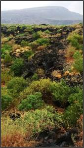
Where people are farming, the earth is visibly richer and more fertile. There are large, irrigated farms along the Awash River – mainly state and private sugar plantations in what were once dry-season grazing areas. These give way to grassland and shrubland at lower elevations. The black earth surrounding the area of a dormant volcano has an abundance of the drought-tolerant acacia, which provides the main fodder for many animals.
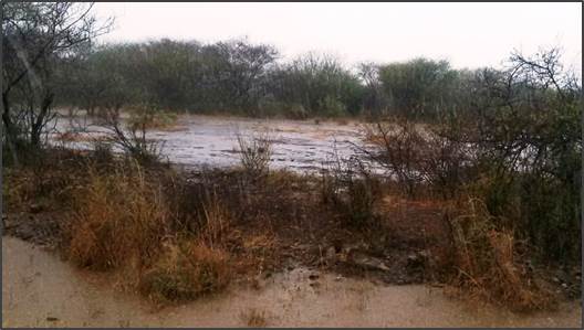
Driving out of Adama (the town, formerly known as Nazareth) it starts to rain heavily – the second time in a week even though it’s not rainy season – causing flash flooding. While good for animals, this is bad news for the ‘agro’ side of the agro-pastoralism and farming households. Untimely downpours like this are potentially disastrous for those still harvesting their teff as it can damage the crop on the stalk, washing away the seed.
Later we pass through two urban spaces on the route between Adama and Awash town: Wencheti, a busy truck stop, teeming with lorries and shiny tuk-tuks that we’d started to see at Adama; and bustling Metehara, a sugar plantation town located on the main road just beyond Lake Basaka. Mohammed explains how the lake is increasing in size, encroaching on the land, and points out the former Awash road running through the lake parallel to the new road we are driving on just a few hundred yards away.

Beyond Awash Town we spend time with a Pastoralist community at Duduf, north of town. People here have been displaced by a sugar plantation. In contrast to some of the rich, fertile earth we saw on earlier sections of our transect, the ground here is degraded and the main plants are an invasive species Prosopis juliflora, that doesn’t allow undergrowth.
This area was once good rangeland but it has been badly impacted by overgrazing, over-population and a series of droughts. The rifle-toting herder is a reminder that conflict over resources is a keen reality in everyday lives here. People tell us they have been repeatedly affected by drought at what they feel is an increasing frequency over the last 20 years, while over the same period – and linked to socio-cultural factors – their use of climate forecasting through indigenous knowledge has fallen, making them vulnerable to food crop shortages and to livestock losses. Herders explain they are also more likely to engage in ‘distress sales’ of livestock (selling at low prices) as a coping strategy in times of severe heat. Other strategies include purchasing grass from higher ground for their livestock, and exploiting groundwater resources through underground water pumping.

The trip, the first of our scoping visits to the region, forms a key part of making sure that ASSAR research is well-grounded in local realities from the start. It has provided a great opportunity for engaging early with a wide range of people, including those living in semi-arid areas who experience the impacts of climate change in very real ways in their day-to-day lives, providing a strong foundation for the next visit in February 2015.