Mapping invasives in India’s Tamil Nadu with smartphones

A new approach to mapping invasives from ATREE and partners makes it easy for researchers, officials and schoolchildren to map the spread of invasive plant species. By Milind Bunyan and Lucia Scodanibbio.
Invasive alien plants can be a thorn in the side of communities in India’s Tamil Nadu, particularly in the Moyar-Bhavani region. Invasives negatively impact the growth of native species as well as ground-water levels and can affect fodder availability. They include plants like Prosopis julifora, which occurs as bushy thickets.

To better understand the spread of invasives in Tamil Nadu, the Ashoka Trust for Research in Ecology and the Environment (ATREE) and its partners are piloting the use of the ODK Collect application which makes it easy for researchers, practitioners, Forest Department officials, and schoolchildren to identify and map invasives using Android-based smartphones and tablets. By using the camera and GPS that most smartphones come equipped with, users can provide spatially explicit, verifiable information on the location of these invasive alien plants in the landscape.
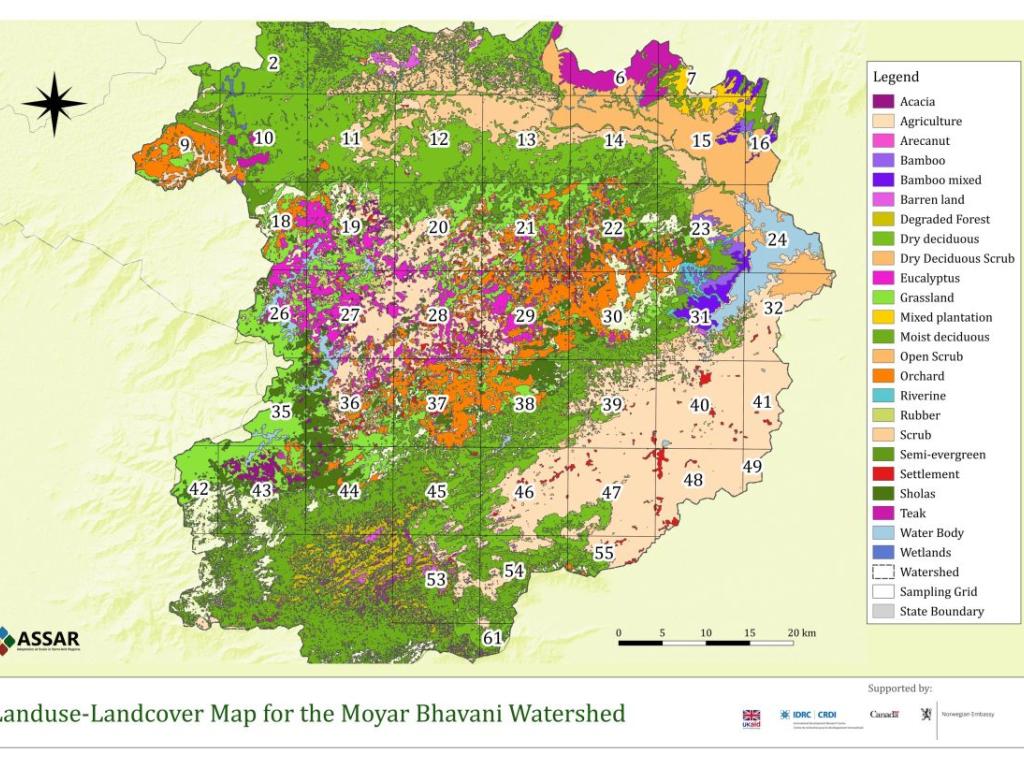
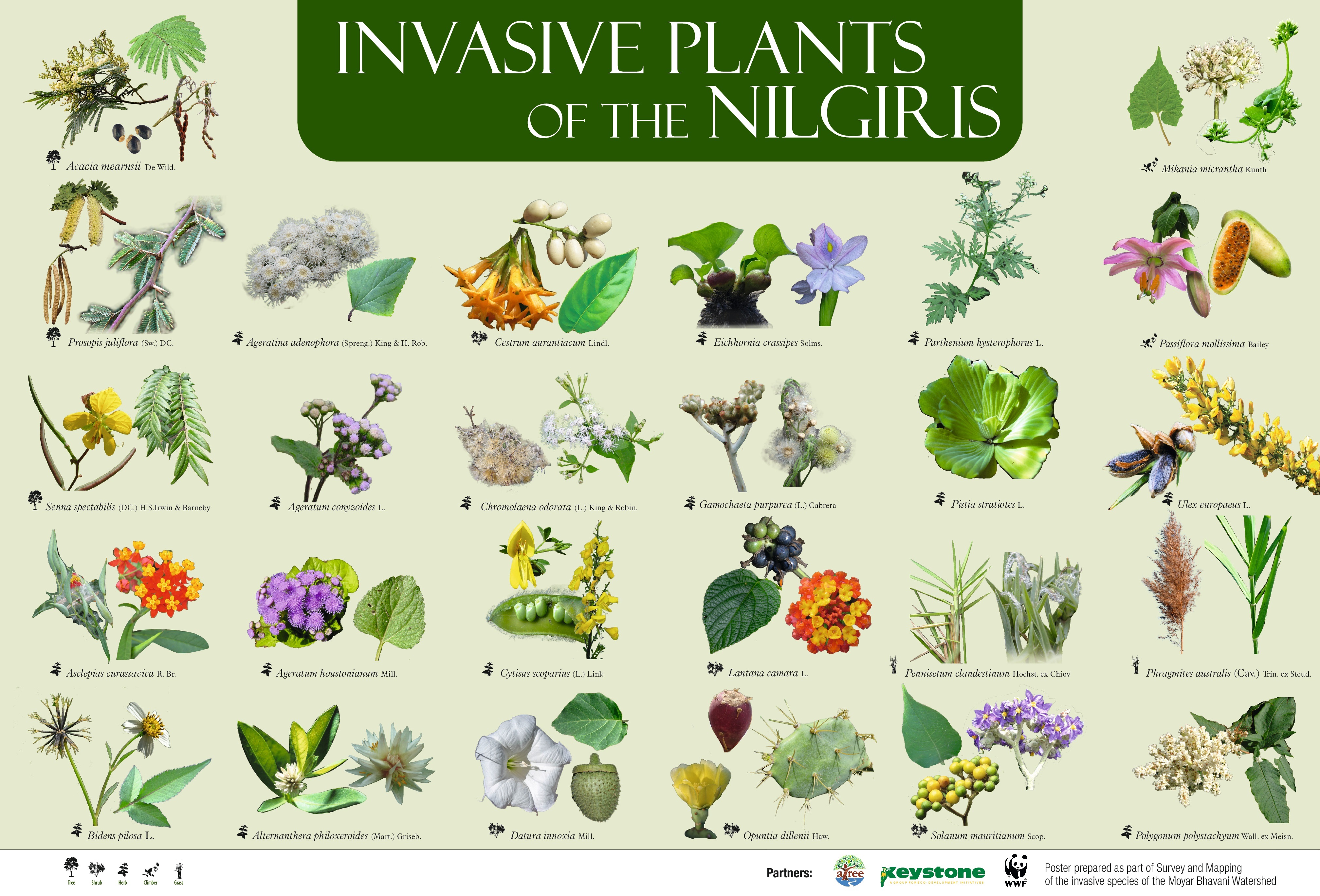
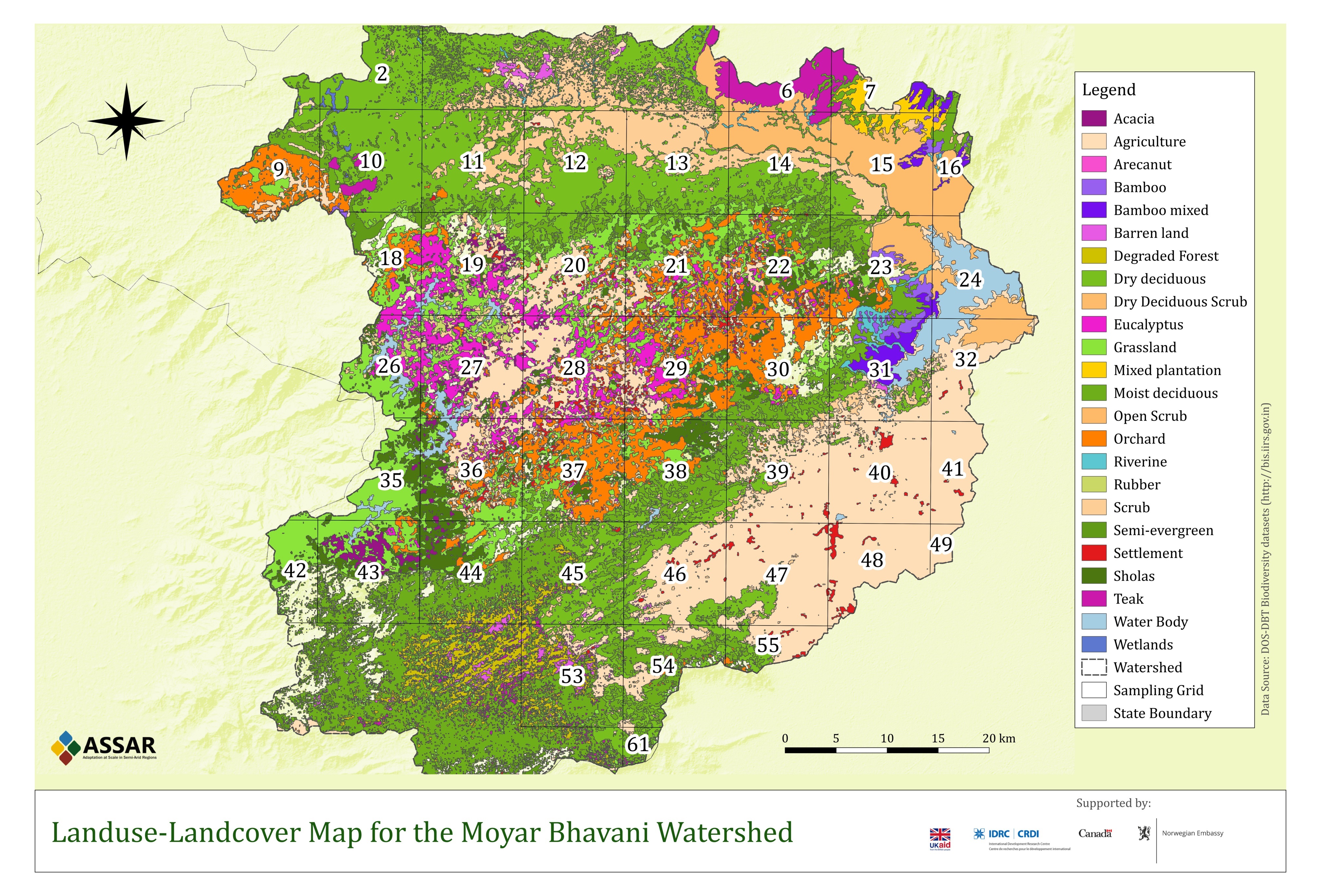
Working with a team of experts from the Keystone Foundation and WWF-India, a total of 89 invasive alien plant species were listed from the Moyar-Bhavani landscape. This list was then pared down to a manageable 27 species and includes plants that represent the greatest threat to ecosystems and livelihoods across the landscape's elevation range. A foldable invasive species identification key was also created to assist users in identifying these shortlisted invasive alien plants.The reverse face of the identification key has a Land Use and Land Cover (LULC) map of the Moyar-Bhavani that lead organisations can use to plan ‘citizen-science mapping walks’ so that land-use types in a grid are sufficiently represented.


Map and key for identifying and locating invasives in Moyar-Bhavani, developed by ATREE and partners.
Using citizen science to create an invasives atlas
ATREE’s collaborative mapping effort began in mid-2017 and is called Participatory Assessment of the Regional Distribution of Exotic Species in India (PARDESI); in Hindi, “pardesi” literally means “not from this land.”
PARDESI is intended to complement and build on the 600 ground truth points and 50 vegetation plots that the ATREE team has collected through the ASSAR project to map Land Use Land Cover (LULC), and assess the impacts of invasives on native ecosystems.
Through PARDESI, which is in the pilot stage, ATREE has been able to conduct a series of skill-building workshops with the Keystone Foundation, WWF and the Forest Department on the use of the app. ATREE’s partners are also working with schools and higher-education institutions in the region, teaching them about invasives and their impacts, and seeking their assistance in mapping invasives using the app in the field.
Using a citizen-science approach, PARDESI aims to create an atlas for invasive plant species, leveraging the energy and enthusiasm of communities and NGOs with the expertise of research organizations. If the methodology tested in the pilot is successful, the team plans to replicate it for the entire Western Ghats area and develop a long-term monitoring system in the region.
ATREE’s previous work with the invasive black wattle (Acacia mearnsii) and its current engagement with government departments through the PARDESI initiative is positioning the organisation as a key knowledge partner for invasives management. There is, however, much work to be done. Present forest management strategies do not address the issue of invasive species apart from generic removal plans in the region. Therefore, the next phase will need to include the promotion of a co-management strategy where communities could benefit from invasive species management. The first steps in that direction are already in the pipeline, so watch this space!
Milind Bunyan is a research scientist at the Ashoka Trust for Research in Ecology and the Environment (ATREE).
Lucia Scodanibbio is the project manager for the ASSAR (Adaptation at Scale in Semi-Arid Regions) project.
Photo credit: Lucia Scodanibbio.
*Blog updated August 24, 2018.